
Locate Your Neighborhood On World's Largest Online Database
By Laura Branton
January 14, 1998
 Have
you visited the world's largest online database? Check it out! You will
join millions of others who have located their homes, work places, and
even favorite vacation spots. A cooperative research and development partnership
between the Microsoft Corporation and the U.S. Geological Survey (USGS)
has resulted in the creation of the Terraserver. The technology and infrastructure
were created by Microsoft and the data were provided by the USGS.
Just How Big?
On June 24, 1998, the USGS and Microsoft unveiled Terraserver during Federal
Enterprise Day in Washington, D.C. The name Terraserver refers both to
the content of the data and the size of the dataset; "terra" is Greek
for Earth and a terabyte is 1 followed by twelve zeros or 1,000,000,000,000.
The Terraserver site contains 3.9 terabytes of stored uncompressed images.
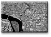
The Terraserver literally is a databank of aerial photographs and satellite
images. Image clarity and retrieval speed were goals of the partnership.
The USGS map data consists of Digital Orthophoto Quadrangles (DOQ) of
the U.S., which required modification to ensure that the data could be
retrieved quickly, easily, and clearly.
To prepare the DOQ for display on the Web site, a complicated method of
modification was necessary. The modification included sectioning, resampling,
and compressing the data. The USGS provided technical assistance to Microsoft
on how to process the geospatial imagery and presentation.
First Step Toward a "Gateway to Earth"
The USGS currently has more than 60,000 digital aerial images that cover
approximately 30 percent of the conterminous United States. "We are very
excited about this project. This application is the first in a series
of steps which allows the USGS to create a 'Gateway to the Earth.' Our
science produces data and information for processes occurring in, on,
and around the Earth, and the Internet is the ideal venue for us to deliver
this information to the citizens of this country," said USGS Associate
Director Barbara Ryan.
You Can Download Your Neighborhood's Image for Free
For Terraserver users, it is very easy to select an area by name, or from
an image of a large area and zoom in to identify their neighborhood, favorite
theme park, or ball field. In addition, users can download the image they
see on their screen to their own computer for free. To purchase a full
resolution digital file, the user must link to a USGS site for ordering
information.
The data from the Terraserver are useful for a variety of activities.
Terraserver will help commercial real estate developers to better understand
population densities around a possible project site; environmental groups
can gauge the impact of natural resource planning; state agencies can
monitor companies for pollution violations; and, children can use the
images to accompany school reports.
Terraserver has opened the door to unparalleled access to satellite and
aerial photography. Remember, the next time you want to view your favorite
places from high above, visit Terraserver
For More Information
Contact: Hedy Rossmeissl at (703)-648-5780 or e-mail: hjrossmeissl@usgs.gov.
National Mapping Division
National Center
Reston, VA 20192
About the Author
Laura Branton is a Women's Executive Leadership detailee at the United
States Geological Survey. You may contact her at (703) 648-4282 or dirguest@usgs.gov.