
|
Digital Maps: An Idea Whose Time Had Come
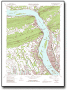
Although moderately priced at $4 a map, they are very expensive to produce and revise. It takes 55,000 of these maps to completely cover the continental USA - a feat finally achieved by the USGS, after decades of production, in 1993. In the early 1990's, employees at the Mid-Continent Mapping Center (MCMC), a major production facility for the USGS National Mapping Division (NMD) located in Rolla, Missouri, noticed the rapid growth of Geographic Information System (GIS) use among private and public mappers and map users. This growing customer segment wanted digital maps that would display on computer monitors. Recent advances in scanning, storage and processing technologies made it possible to make such digital maps from USGS quadrangles.
The Idea -> The Development -> The Production The idea of scanning a USGS topo map had been around for years, and no one knows who actually initiated it. In January, 1994 a team of USGS employees began to investigate the demand for digital maps, and identify the feasibility of scanning topographic maps with the latest scanning equipment. They gathered information from customers, USGS scientists and leadership, and private vendors. Within 6 months, the team had a working prototype, demonstrated their work to USGS leadership, and predicted strong demand based on their work with customers. They called the new product a Digital Raster Graphic (DRG). NMD headquarters approved formal product development, and the team began investigating how to best achieve nationwide coverage of 55,000 DRGs. An Innovative Partnership and other cooperative agreements with private and public vendors to produce DRGs were in place by October 1995. Nationwide coverage, including the last DRGs of the Pacific Islands territories of the USA, was achieved in March 1998 - less than 2 ½ years to produce more than 55,000 scanned maps, a major achievement for the USGS and its partners. In a little more than 4 years, the process went from concept to complete national coverage of a major new product. Happy Customers If sales are an indicator of satisfied customers, the DRG is performing well, to say the least. DRGs are packaged on Compact Discs (CD), with about 67 digital maps on each CD. Selling at $32 per CD (plus $5.00 handling charge), that's about 53 cents per map. Sales in FY98 were $921,000. This equates to about 1.9 million digital quadrangles for the first full year of product sales. Feedback from customers regarding uses of DRGs has been very positive and varied. One State agency is using the DRG to help monitor the effects of sludge runoff on the environment. The Federal Emergency Management Agency, as well as many State emergency management agencies are using DRGs for evacuation planning. The data were used to help monitor clean-up work in the Fargo, ND, area following the 1998 flood. Private companies, from realtors to tree farmers use them. Spin-offs are right around the corner - companies are writing software for aircraft and automobile tracking/navigation systems to use DRGs for display on a screen in private planes and automobiles. Finally, an unexpected, but delighted customer is the National Mapping Division of the USGS. Employees at Mid-Continent Mapping Center are refining a graphic revision process that uses DRGs to help cut revision production time as much as 35 percent. The DRG is certainly a million dollar idea whose time has come! For more information about DRGs, visit our Website at http://mcmcweb.er.usgs.gov/drg. Contact: |
 Demand
for the U. S. Geological Survey's 7.5 minute topographic quad maps
has been strong for decades. Customers from all walks of life have
found uses for these products - from siting dams, to planning a
birdwatching trip.