![]()

![]()
NASA Brings Space
Science to Weather Predictions
On January 11, 2000, NASA Administrator Daniel S. Goldin outlined NASA's role in studying Earth's climate - - a commitment to scientific research and technology development that will help forecasters make even more accurate weather predictions in the new millenium. Speaking to the American Meteorological Society, Goldin discussed how NASA technology and climate studies helped predict such dramatic events as El Nino and La Nina. For the future, NASA has set goals for its Earth Sciences research and technology development projects that may result in new satellite technologies and models to help NWS replace the common three-to-five day forecasts of today with equally accurate 10-to-14 day forecasts.
With the help of satellite data and better computer modeling techniques, meteorologists in the next decade may be able to predict El Nino weather conditions up to 15 months in advance and detect hurricanes far enough ahead to better protect life and property, Goldin told the meteorologists. "What most people don't know is that our efforts to open the space frontier are largely based on our quest to understand our own planet," he said. "Our development of new technologies and Earth-observing spacecraft complement the vital work of our sister agencies in weather prediction and global climate modeling."
![]()
![]()
![]()
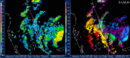
Hurricane prediction is a top priority for many NASA researchers. Landsat 7, an Earth-mapping satellite that provides imagery of the planet for use in understanding natural events all over the world, helps scientists understand the effects of hurricanes and their flooding of coastal regions. QuikSCAT, a satellite launched last spring, tracks wind currents over the ocean's surface. This information helps researchers understand the interactions between Earth's oceans and the atmosphere so they can better predict the evolution and movement of severe storms. (In fact, in late summer 1999, the radar scatterometer Sea Winds on the QuikSCAT observed three hurricanes threatening both the east and west coasts of the U.S. at the same time!) And, TOPEX/POSEIDON, a NASA-French mission that uses radar to study ocean-surface topography and heat content, is giving scientists more clues into how El Nino and other ocean events affect the weather that crosses our nation each day.
NASA, and its partners in weather research, also gained intriguing new information about upper-level winds that drive hurricanes and the devastating impact of the storms as they collide with mountains from a seven-week "partnership" study conducted last summer. NASA, NOAA, and several universities collaborated during the Third Convection and Moisture Experiment (CAMEX-3) to gauge the strength of Atlantic hurricane winds and rainfall. The volume of data collected will keep researchers busy for quite awhile!